|
|
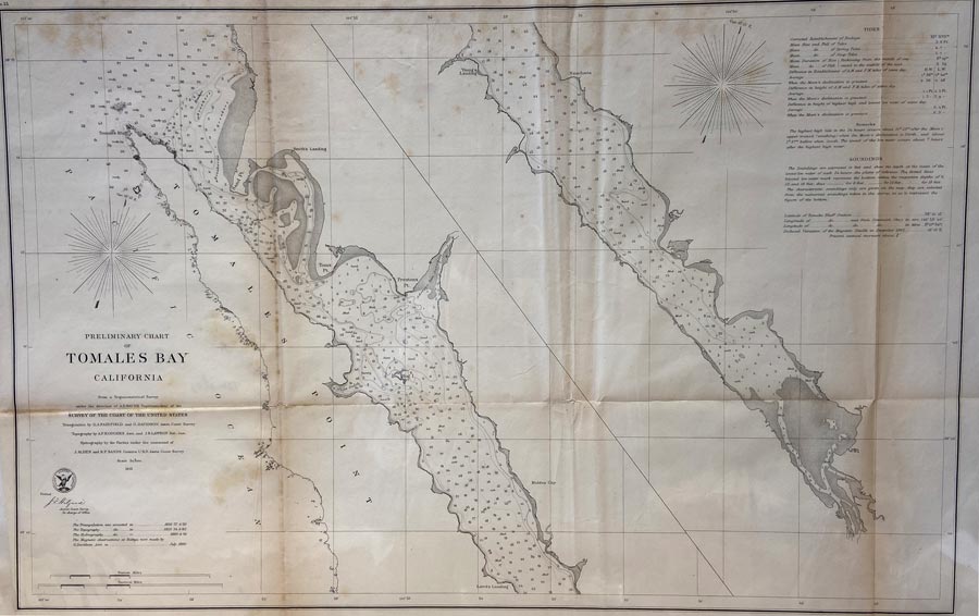
Maps and Cartography - California
Preliminary Chart of Tomales Bay California, From a Trigonometrical Survey under the direction of A.D. Bache, Superintendent of the Survey of The Coast of the United States. No.23 (1861)By: Bowen & Co. lith. Philada. - Electrotype Copy No.1 by G. Mathiot USCS Size: 18.00 H x 26.50 W inches Source: United Coast Survey Item #: 130913 United States Coastal Survey of Tomales Bay in California. Gives Tides information, and Soundings of depth measured in feet. Map indicates location of Tomales Bluff, Hog Island, Laird’s Landing, Young’s Landing Rancheria, and Preston’s Point. $225 |