|
|
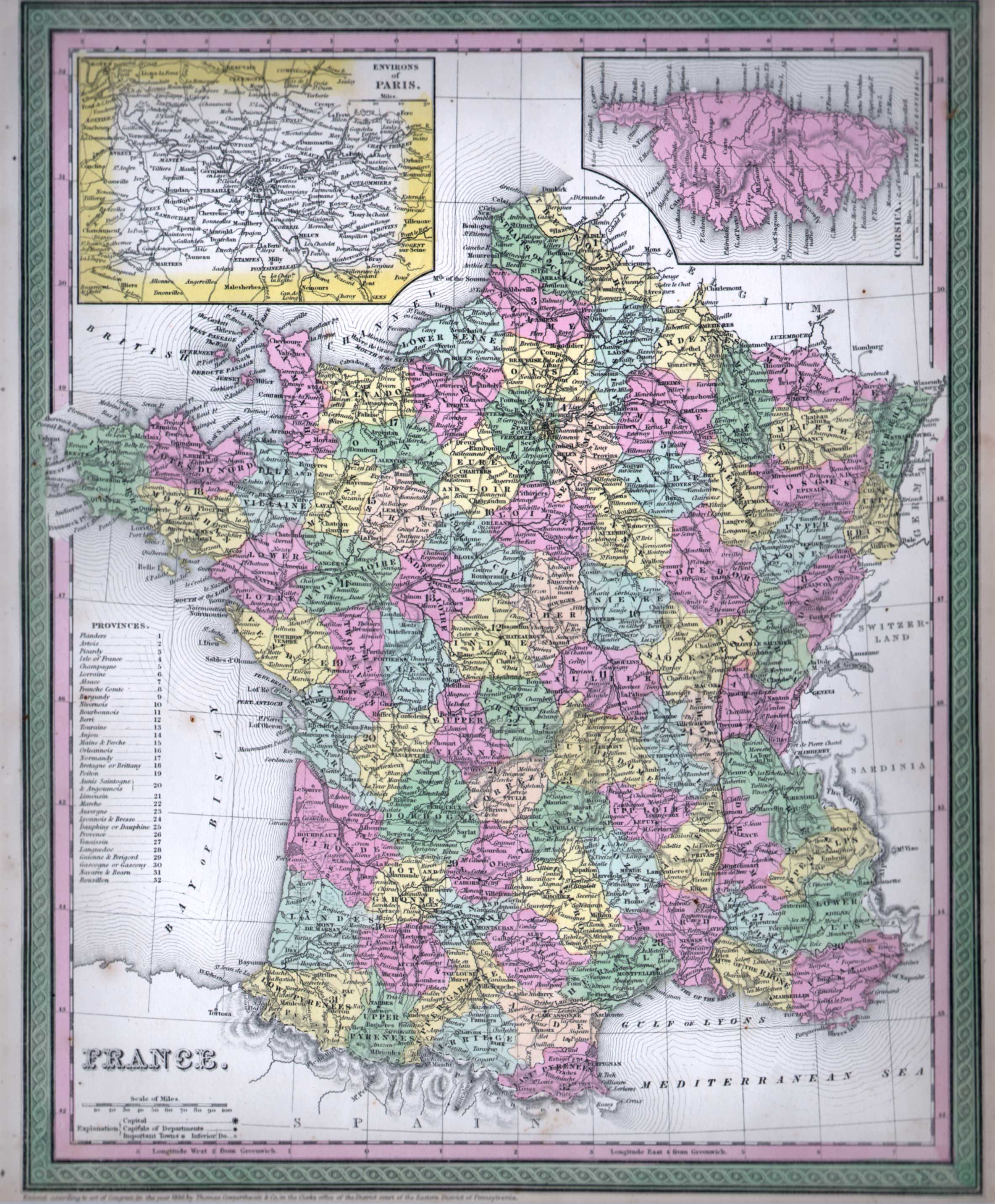
Maps and Cartography - Europe
Map of France (1850)Size: 16.00 H x 13.00 W inches Source: Mitchell's Universal Atlas: A New Universal Atlas Containing Maps of the Various Empires, Kingdoms, States and Republics of the World, with Special Map of Each of the United States, Plans of Cities, &c. Published by Thomas, Cowperthwait & Co., Philadelphia, 1854 Item #: 81096 A fine hand-colored map of France showing each Department, major cities and towns, rivers, ports, provinces, lakes, etc. With an insert of the Environs of Paris and an insert of Corsica. $300 |